Long Valley access update
A Special Protection Area gives wildlife a high level of protection. Of course, protection for wildlife, means protection for greenspace, and we all benefit from that. But even before it was declared a Special Protection Area, much of our patch was protected by the nature of its land use. A large proportion is commercial forestry plantation, managed by the Forestry Commission and the Crown Estate. And nearly 50% of it is owned by the Ministry of Defence and in active use for military training. I don’t think it’s overly dramatic to say, that without forestry and the military, much of our fantastic heathland would have been lost to development long ago!
Which brings me onto Long Valley, the area south of the Aldershot Road, east of Church Crookham. It’s marked as a driver training area on the Ordnance Survey map and known to the military simply as B4d.
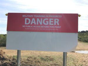
Long Valley sign
Until recently this area had no fence and was open to the public. With increasing military use – and the obvious dangers of a driver training track – funding was found in early 2018 to install a secure fence to protect people from danger. Large flip signs have now been installed at access points to indicate when training is in progress and public access is strictly prohibited. It may not always be obvious that training is taking place, it’s not all loud bangs and high speed vehicles. There’s covert stuff too, sniper training and young cadets getting their first taste of sleeping outside on an exercise!
In reality, the concentration of training means the area will often be closed, and it may even be that it’s only open on the occasional holiday such as Christmas. Once this situation becomes clearer, the military will be able to publish a timetable, so that no one has a wasted journey. Watch this space, we’ll be working closely with them to bring you up to date news.
While Long Valley is no longer freely open to the public, other areas are being freed up. Caesar’s Camp, for example, off the B3016 Odiham Road through Upper Hale, near Farnham, has less training and is generally always open for responsible use in accordance with byelaws.
Our website also suggests many more great alternatives including Wellesley Woodlands, a fantastic public space with marked trails ranging in length from ½ a mile to just under 6 miles – and several good free car parks, including at Claycart Road, Aldershot GU11 1QA (SU 85339 51122) and Puckridge Hill Road, Aldershot GU11 2HF (SU 85162 52477). Once a training area, the woodlands have been transformed by the Land Trust and the Blackwater Valley Countryside Partnership into inviting greenspace. Take a look at the dedicated Wellesley Woodlands website for a detailed map showing all the trails and car parks.
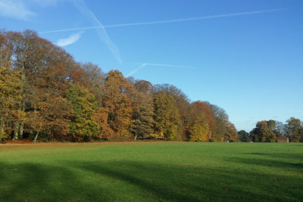
Wellesley Woodlands
Not far away are Crookham Park, Southwood Woodlands and newly open Bramshot Farm Country Park. All lovely places, we’d be very happy to recommend.
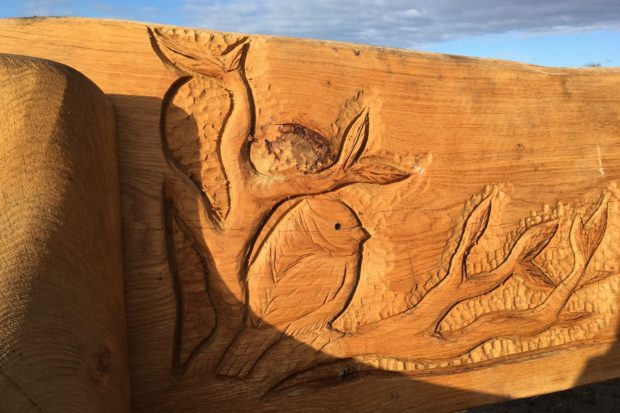
Wood carving at Bramshot Farm Country Park
So while one area has more restrictions, others are being refurbished and opened up. Do take a look at our website for lots of ideas for places to visit, all with free parking. And watch for updates, as there are more in the pipeline!
Senior Warden Sarah
Link to up to date news.